Step by Step Itenerary for Driving the Road to Hana
Below is a list of attractions on the Road to Hana. The starred ()items are the most popular. the list below The blueattractions are places to visit driving from Paia to Oheo Gulch. The green attractions are places to visit heading back from Oheo Gulch to Paia. The orange items are places with rest rooms and/or food.
These directions are designed to get the most out of your time by using the mile marker map. The route to Oheo Gulch stops by the waterfalls (which are mostly on the right) and Oheo Gulch. The route back stops at the beaches, turnouts,and attractions (which will be mostly on the right). By leaving at 6 a.m. you will have easy parking, less traffic and a better experience at Oheo Gulch. If you decide not to go to Oheo Gulch, travel to Hamoa Beach and start your trip back from there. Download PDF printable driving instructions:
From Mile Marker 0 to Oheo Gulch
and
From Oheo Gulch to Paia
click on thumbnail image to enlarge.
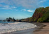
Paia(aprox. 10 miles to mm 0)
is the last stop for gas and supplies. This is a nice town worth exploring on the way back or another day. Mama's fish house is a very popular dining spot. The drive is pretty mostly until about 2 miles to MM1. for more Paia information click here
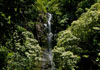
Twin Falls (Just past mm2 heading east)
is the first waterfall you can explore. It is on the private property of Wailele Farms who run the Twin Falls farm stand and operate the tours to the waterfall. You can view the waterfall for free with donations accepted. There are better falls that are free to view, so you can pass this one , if you desire.
Painted Trees (3/4 mile past mm6 heading east)
About 3/4 mile past MM6 keep an eye out for painted eucalyptus trees. There isn't a place to pull over so slow down for a quick picture or view. If you miss them try again on the way back.
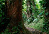
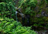
Waikamoi Nature Trail (1/2 mile past mm9 heading east)
A little over half-mile past mile marker 9 on the Hana Highway keep your eyes open for the parking lot (mauka) to the Waikamoi Ridge Forest Trail and Overlook. It is easy to miss due to the fact it's around a bend in the road. After parking in the often crowded lot, head up to the open area to your left to a small overlook with picnic shelters and the Waikamoi trail head.
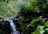
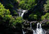
Waikamoi Falls (Just before mm10 heading east)
Use the turnout on right. .The first waterfall is close to the road with a pool. The bigger second waterfall has multiple places to sit at the bottom and let the water fall on you. Be careful as the hike to the bigger waterfall it can be slippery. This waterfall is some times good , and sometimes bad if EMI has diverted the water. If the water is raging, don't even try to get to the 2nd waterfall.
Ka Haku Smoke Shack (4/10s of mile past mm10 heading east)
Ka Haku is a funky little BBQ place along the side of the road. Good BBQ and pricey but what you would expect for being in the middle of nowhere. Forget the morning, it will be closed. You might get lucky if you stop in the afternoon.
Garden of Eden (Half way between mm10 and mm11)
Look for the sign for the road to turn on. This a well maintained beautiful botanical garden with a good bit of walking. There are great views of lower and upper Puohokamoa falls not visible from the road. The park is only open 8am to 3pm . If you are not going to Oheo Gulch, this would be a good stop first thing in the morning.
Lower Puahokamoa Falls (Just before mm11 heading east)
There is a small trail that will take you to the falls. Garden of Eden has blocked access to the upper falls.
Haipua'ena Falls (5/10s of a mile from mm11 heading east)
Haipua'ena Falls is a small waterfall . There is a short trail on the far side of the bridge. You can to a much larger waterfall, but it can be a steep slippery hike.
Kaumahina Park (Just past mm12 heading east)
Kuamahina Park is a small wayside park with bathrooms,exotic plants, picnicking, and a scenic view. There isn't any hiking trails or waterfalls to see. It is the first bathroom since you started the journey, so there will be plenty of cars stopping for the facilities and to stretch the legs.
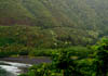
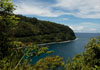
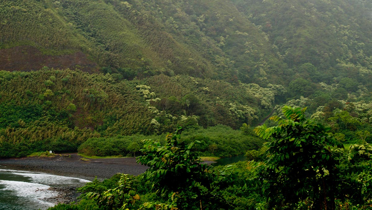
Honomanu Lookout (Between mm13 and mm12 heading west) This lookout with a large parking space, has a closer view of Honomanu Beach and Honomanu Bay.
Cliff Turnout (Halfway Between mm14 and 15)
After mm15 heading back from Hana look for the turnout about 3/10s of a mile on the right. You will be treated to a great view of the coast and Honomanu Bay
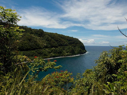
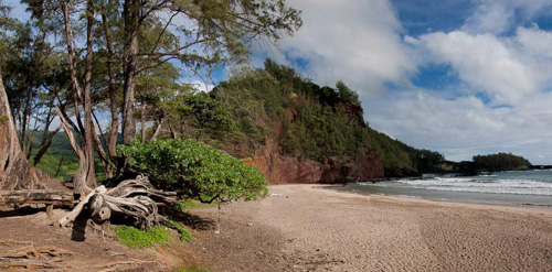
Keanine Peninsula (Between mm16 and 17)
Look for the sign and take the narrow road (on the lee side) down to the peninsula. This is a very rugged beautiful area with a lava shoreline. The sports field is a popular spot for locals and community events. Make sure to stop at Auntie Sandy's for some awesome banana bread.
for more Keanine information click here
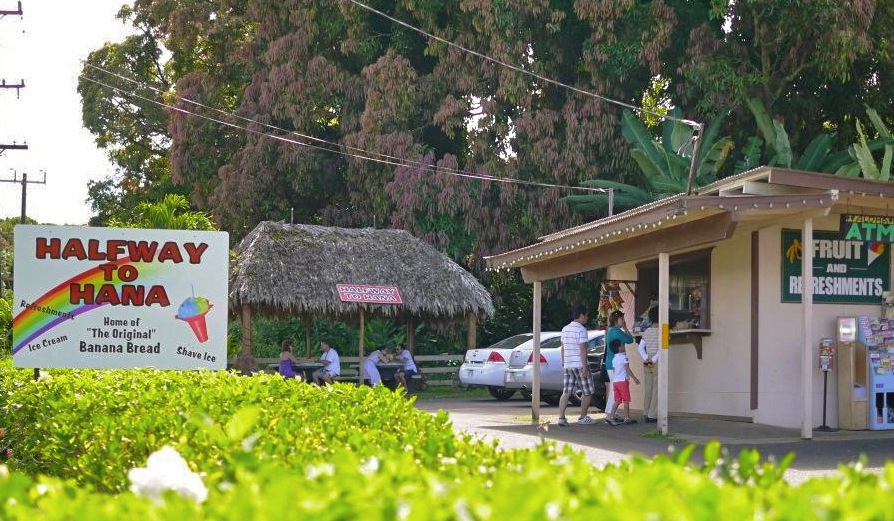
Halfway to Hana (Between mm17 and mm18 )
Small market with drinks and goodies. This is the halfway point to Hana.
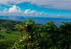
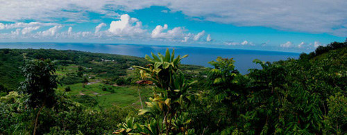
Valley Lookout (Just before mm19 heading west)
This turnout has spectacular views of the coast and farming community below. The green lush valley and blue water make for a beautiful panoramic image.
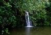
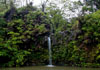
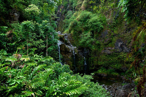
Upper Waikani Falls (About half way between mm19 and mm20 heading east)
A very popular falls located close to the road. Park at the turnout and walk down the road to the falls. Use the trail and make your way down to the pool. This is a nice spot that many people just snap a pic passing by and do not stop to explore.
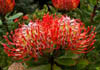
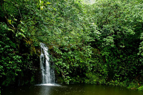
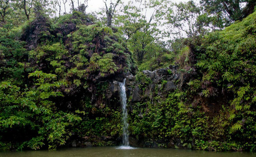
Puaa Kaa State Wayside (Between mm22 and mm23 )
Puaa Kaa State Wayside is a nice rest area with rest rooms. Across from the parking lot is a large beautiful park with exotic flowers and Puaa Kaa waterfall. This a nice spot for a picnic.
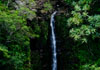
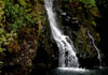
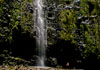
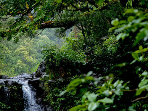
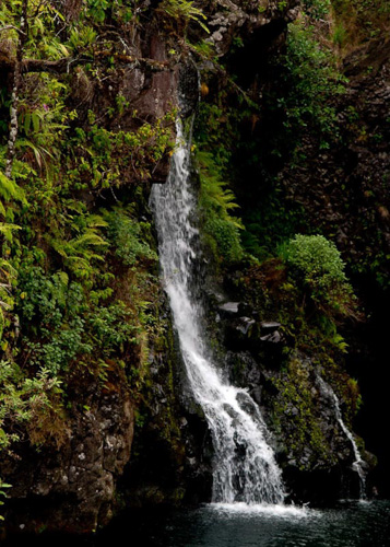
Upper Hanawi Falls (Just past mm23 heading east)
This is one of many falls that feed from the Hanawi Stream as it flows to the ocean. The best view the falls is from the bridge. Upper Hanawi Falls run even in dry months and can get really dramatic after heavy rains.
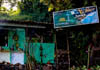
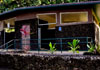
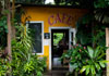
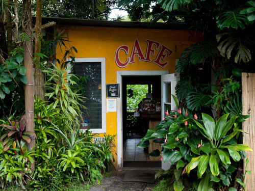
Nahiku Market Place (between mm28 and mm29)
Nahiku Market Place is an Interesting marketplace built in a heavy forested area. There is a cafe, and a few souvenir shops filled with some unusual local merchandise.
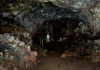
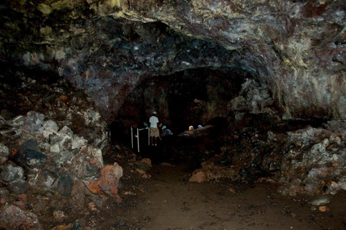
Kaeleku Caverns (8/10s of a mile after mm32 heading west)
Kaeleku Caverns also known as Hana Lava Tube is 1/3rd of a mile long ( the tube is much larger but the is only a small portion of it. Your fee includes flashlights and a map. It is a nice change from most of Maui's attractions. After the tour you can try your luck getting through the red ti maze .
for more Kaeleku Caverns information click here
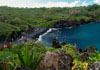
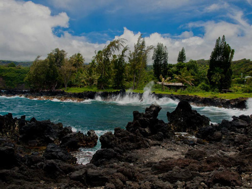
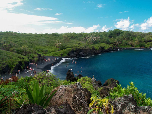
Waianapanapa State Park (Just before mm32 heading west)
Waianapanapa State Park also known as Blacksand Beach is a large park with many activities. The park has hiking trails, caves, lava tubes and of course a black sand beach. The park has a camping area but requires a permit you need to get way in advance. Plan on spending at least an 45 minutes here.
for more info click here
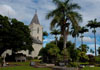
Hana
Hana is a small quaint town . The main attractions would be Hana Bay, the Old Churches, and the Travaasa Resort. There is an airport, although expensive, does offer flights to and from Maui's other 2 airports.
for more info click here
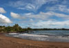
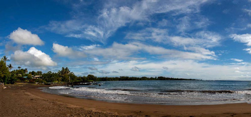
Hana bay (Head down Keawa Place from Highway)
Hana Beach Park at Hana bay is Hana's most popular attraction. The bay is well protected most of the time so this beach is good for swimming and snorkeling . There is a snack shop serving drinks, snacks and some hot food.
for more info click here
Koki Beach ( Turn on Haneoo Road heading east or west-road loops the highway)
Look for the sign and take the narrow road (on the lee side) down to the peninsula. This is a very rugged beautiful area with a lava shoreline. The sports field is a popular spot for locals and community events. Make sure to stop at Auntie Sandy's for some awesome Banana bread.
for more info click here
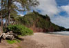
Hamoa Beach ( Turn on Haneoo Road heading east or west-road loops the highway)
Hamoa Beach is about 3 miles east of Hana. If you are coming from Oheo Gulch turn right at Haneoo Rd. the road follows the coast passing Hamoa and Koki beach then ends back at the highway further west. Beautiful beach with a pounding surf. Plenty of shade, picnic tables and rest rooms.. For more info and images
for more info click here
Wailua Falls
Wailua Falls is located about 8 miles south of Hana . It is easy to spot. There will be a parking lot and usually people in the street taking pictures (unless you get there real early). Stop and enjoy the falls. The next 2 miles to Oheo Gulch is very curvy and narrow , yes even more than you have already encountered.
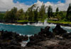
Oheo Gulch
Oheo Gulch is located at Mount Haleakala State Park. . It is a short hike to the pools and waterfalls. Take a dip in the pool and hike around the area. If you got up early you won't be fighting the hundreds of tourists that will arrive shortly. For more fun take the Pipiwai Trail up to Waiamoku Falls (see below)
for more info click here
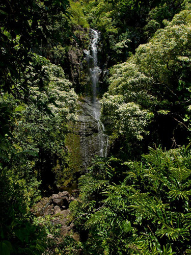
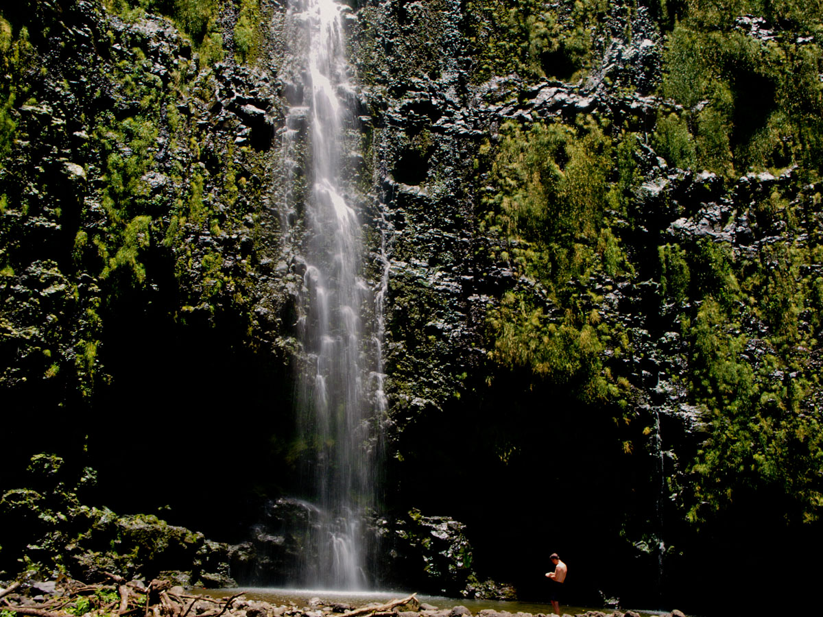
Pipiwai Trail and Waiamoku Falls (trail starts at Oheo Gulch)
The Pipiwai Trail starts at at the left side of the pools. The 5 mile hike (round trip) follows the stream passing through a bamboo forest and ending at the 500ft. high Waiamoku Falls. The hike is pretty easy on a mostly even trail, crossing the stream twice. Wear hiking boots or water shoes as it can get muddy and slippery.
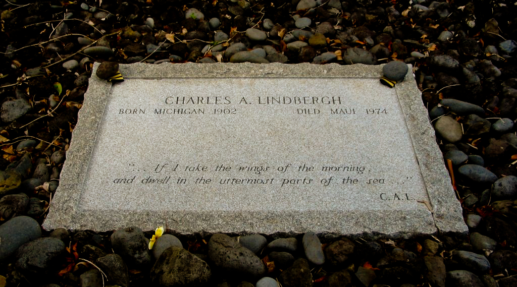
Lindbergh Grave
If the road is open you may opt to drive another mile down to Lindberg Grave. You can drive south all the way around the island , but most rental agency's frown on this. If you do get stuck on this winding, narrow partially dirt road, you will pay for towing, no matter who is a fault.
 )items are the most popular. the list below The blue
 attractions are places to visit driving from Paia to Oheo Gulch. The green
 attractions are places to visit heading back from Oheo Gulch to Paia. The orange items are places with rest rooms and/or food.
  (aprox. 10 miles to mm 0)
is the last stop for gas and supplies. This is a nice town worth exploring on the way back or another day. Mama's fish house is a very popular dining spot. The drive is pretty mostly until about 2 miles to MM1.
(aprox. 10 miles to mm 0)
is the last stop for gas and supplies. This is a nice town worth exploring on the way back or another day. Mama's fish house is a very popular dining spot. The drive is pretty mostly until about 2 miles to MM1. 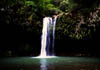 (Just past mm2 heading east)
is the first waterfall you can explore. It is on the private property of Wailele Farms who run the Twin Falls farm stand and operate the tours to the waterfall. You can view the waterfall for free with donations accepted. There are better falls that are free to view, so you can pass this one , if you desire.
(Just past mm2 heading east)
is the first waterfall you can explore. It is on the private property of Wailele Farms who run the Twin Falls farm stand and operate the tours to the waterfall. You can view the waterfall for free with donations accepted. There are better falls that are free to view, so you can pass this one , if you desire.